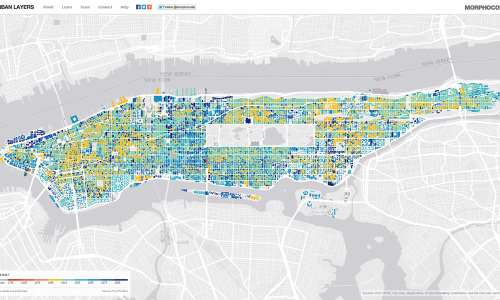
Layers of NYC is an interactive map created by Morphocode that explores the structure of Manhattan’s urban fabric.
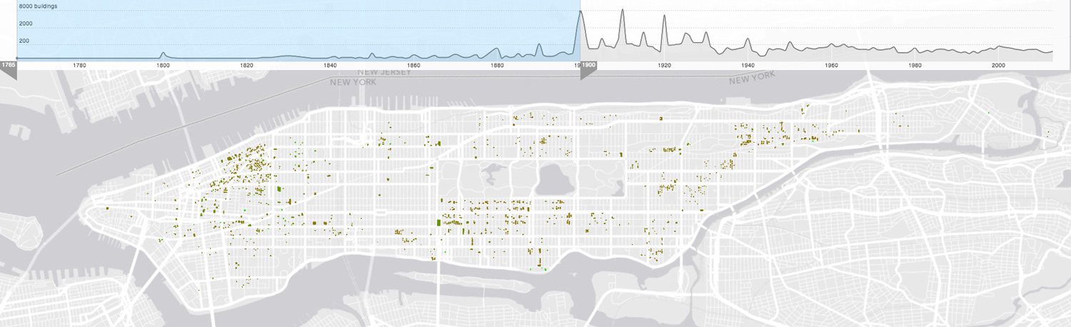
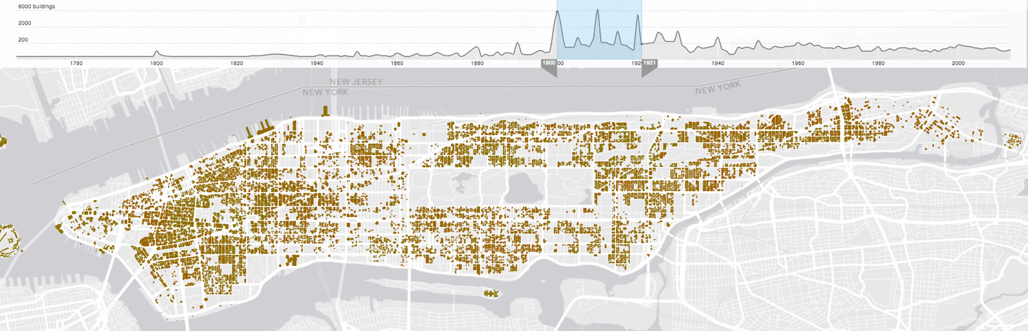
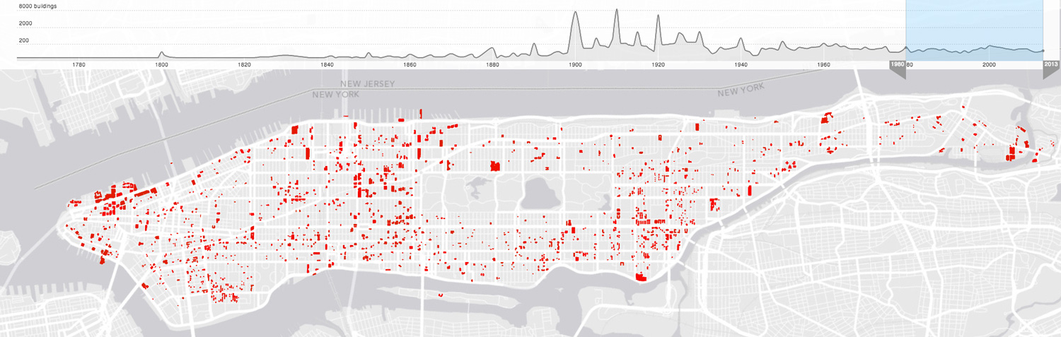
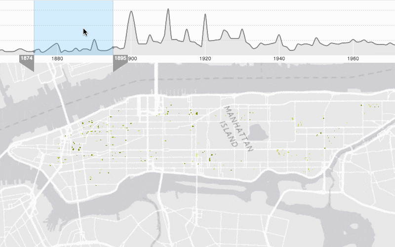
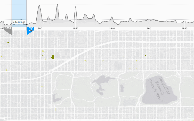
The map lets you navigate through historical fragments of the city that have been preserved and are now embedded in Manhattan’s densely built environment. The rigid archipelago of building blocks has been mapped as a succession of structural episodes starting from 1765.
You can use the timeline sliders to identify some of Manhattan’s oldest buildings; discover how the beginning of the 20th century marked the island skyline or to define the distribution of building activity over the last decades.
We’ve used data from PLUTO and the latest technology from Mapbox – Mapbox GL to create a highly interactive experience.
The map is currently in beta and will soon be available online. Here is a preview:
User Interactions:

I am very interested in compiling our buildings into the open nyc data. Does the datasets provided work with Autodesk Infraworks?
Hi,
The dataset containing NYC building footprints is in the shape file format (SHP).
Autodesk Infraworks should be able to open it.
Regards