Tomorrow
we shall have to think up signs,
sketch a landscape, fabricate a plan
on the double page
of day and paper.
Tomorrow, we shall have to invent,
once more,
the reality of this world.
Octavio Paz, “January First”
Curious Atlases encompasses some of the most interesting map collections we’ve come across recently.

Pocket Atlas of Remote Islands: Fifty Islands I Have Not Visited and Never Will
This Atlas by Judith Schalansky features maps and stories from fifty remote islands that are far beyond the reach of conventional tourism.

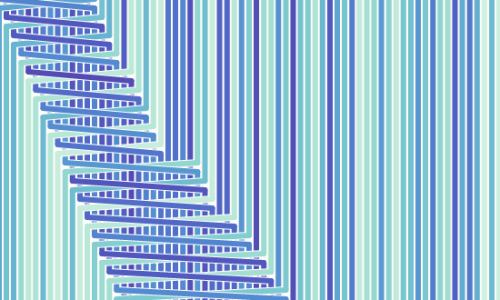
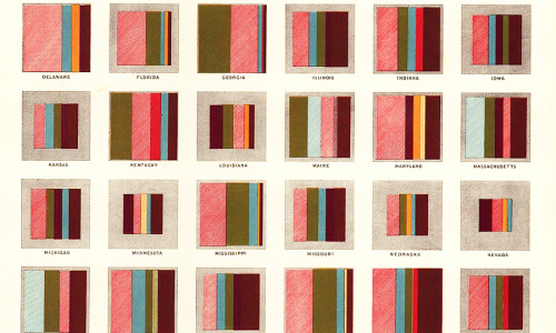
Atlas of Prejudice
History is a strange creature. It has the amazing ability to blind us with our own reflection when we peek over its deep, mysterious waters. Many of us drown in them just like the mythological Narcissus, whose infatuation with his own beauty was stronger than his survival instincts.Those who don’t know history may be bound to repeat it. But even people who know it may follow the same fate if they interpret it exclusively in their own favor.
Contemplating Prejudice, an excerpt from the Atlas of Prejudice, Volume 1 by Yanko Tsvetkov.
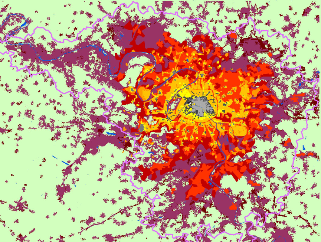
Atlas of Urban Expansion
Urban Growth has been a trending topic for quite some time and that’s no surprise since the world’s urban population reached 3.9 billion this year. By 2030 we are expected to have 41 mega-cities with population of 10 million inhabitants and by 2050 66% of the world’s population shall be urban. Meanwhile, medium-sized cities and cities with less than 1 million inhabitants in Asia and Africa will be the fastest-growing urban agllomerations. Even though there have been considerable variations across the globe in rates of urbanization since 1950’s it is clear that the rapid urbanisation is now a global concern.
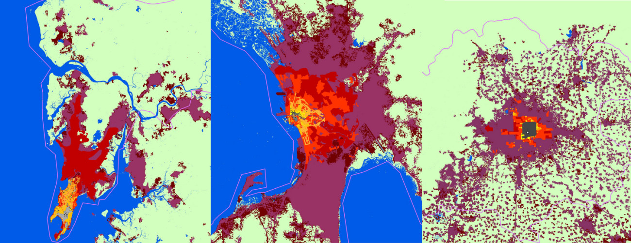
The authors of the Atlas have examined four key attributes of urban expansion: Urban land cover, density, fragmentation, and compactness. These discrete spatial attributes have been studied over time in cities around the world and present an overview of the process of global urban expansion. The Atlas provides pairs of urban land cover maps – one circa 1990 and one circa 2000, of 120 cities around the world. It also contains composite maps of a global historical sample of 30 cities, showing their expansion from 1800 to 2000.
The Atlas will be updated and expanded in a new 2015 edition. For further information you can take a look at the following papers: The Persistent Decline in Urban Densities; The Fragmentation of Urban Footprints; A Planet of Cities: Country Estimates and Projections of Urban Land Cover, 2000-2050
All the data and images from the Atlas are available for free download.
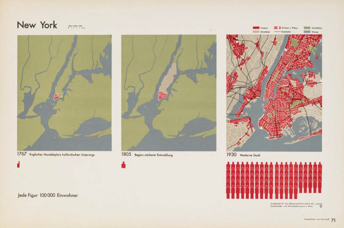
Otto Neurath’s Atlas “Society and Economy”, 1930
Otto Neurath was a progressive philosopher of science, sociologist, and political economist.
He was one of the leading figures of the Vienna Circle and made a significant contribution to the 20th-century Modern Movement.
Neurath’s concepts of the “global polis” put him in contact with leading architects of the time such as Adolf Loos and Le Corbusier. He collaborated with the International Congress of Modern Architecture (CIAM) and advocated the idea of creating an international language of urban planning and design.
Together with the graphic designer Gerd Arntz, Neurath created the highly influential ISOTYPE – International System of TYpographic Picture Education.
View a pdf version of the Atlas here.
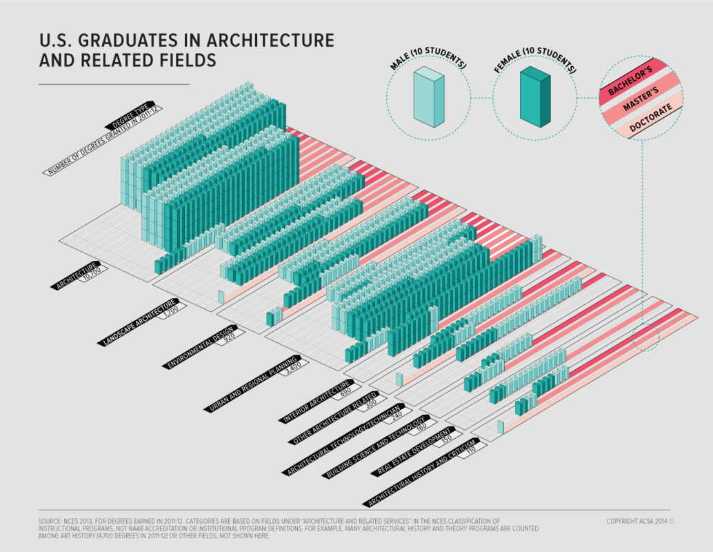
ACSA Atlas
The ACSA Atlas is an ongoing project examining architectural education in relationship to demographics, higher education, the profession, and the economy.
Vinex Atlas
It was in the early 1990s that the Dutch Ministry of Housing, Spatial Planning and the Environment published the supplement to the fourth report on spatial planning. This policy document is known under the acronym Vinex. In its wake, hundreds of thousands of dwellings were erected throughout the Netherlands: tagged Vinex districts, they have always been a source of debate.
The Vinex Atlas gives the first in-depth account of the entire Vinex stock, describing 52 districts aided by aerial views from the mid-nineties, plans, site data and recent on-site photographs.
More about the Atlas on Studio Goost Grootens website.
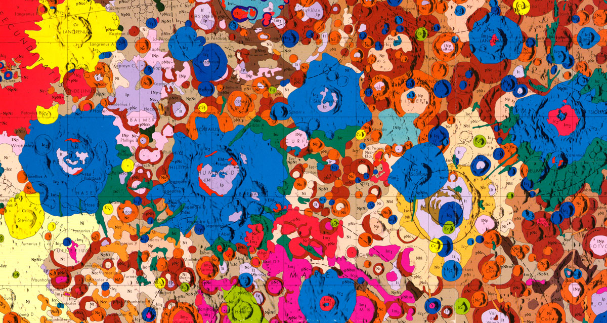
Geologic Atlas of the Moon
Published by the U. S. Geological Survey this Atlas consists of an extensive collection of maps and data that are accessible online.
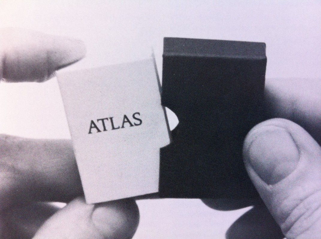
The Conquest of Space. Atlas for the Use of Artists and the Military
Marcel Broodthaers designed this miniature volume in 1975: the book measured 38 x 25 mm and was boxed.
The reader of an ordinary map or atlas would expect to see blue lines and would know to interpret these as rivers or streams. Interpreting the map requires prior knowledge of a set of visual conventions, signs and symbols that indicate meaning. Broodthaers’s Atlas disrupts these conventions, as well as the sense of scale, in order to question them. It develops ideas that the artist had previously explored in works such as Utopian Map of the World 1968.