We are happy to announce that Urban Layers is online!
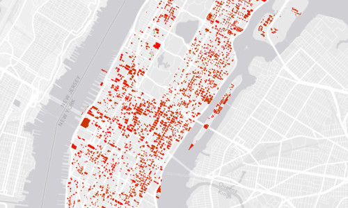
Urban Layers is an interactive map created by Morphocode that explores the structure of Manhattan’s urban fabric . The map lets you navigate through historical fragments of the borough that have been preserved and are now embedded in its densely built environment.
Interface
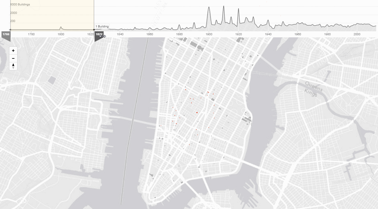
Use the sliders to identify some of Manhattan’s oldest buildings; to discover how the beginning of the 20th century marked the island’s urban environment or to explore the distribution of building activity over the last decades.
The Making Of
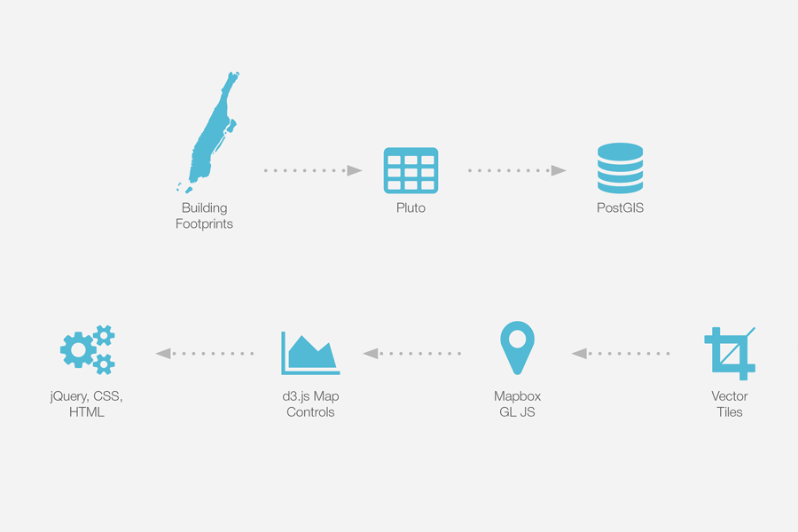
Urban Layers is based on data from PLUTO and the NYC building footprints dataset. We’ve used Mapbox GL JS to render the map. If you are interested in the whole process of making be sure to visit our Academy page and learn more about The making of Urban Layers.